


MAPinr - KML/KMZ/OFFLINE is a must-have tool for anyone who wants to manage their maps and routes with precision and plenty of customization. Designed for explorers, adventurers, and professionals alike, this app allows you to manage KML and KMZ files, create markers, plan routes, and navigate offline, making it an essential companion for all your travels and field projects.
Personalized maps at your fingertips
One of MAPinr - KML/KMZ/OFFLINE's greatest strengths lies in its ability to work with KML and KMZ files, which you can upload, view, and edit directly from the app. This allows you to integrate customized data, such as routes, points of interest, and relevant geospatial data, all with unparalleled accuracy and clarity. Whether you're planning an expedition or managing a field project, this app provides you with all the tools you need to visualize and organize your data in a clear and accessible environment.
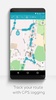
Offline navigation
One of the most outstanding features of MAPinr - KML/KMZ/OFFLINE is its ability to operate without an Internet connection. You'll be able to download maps to use in remote areas where there's no access to mobile networks, making it an ideal choice for hikers, cyclists, and travelers who venture outside of urban areas. In addition, offline navigation won't negatively affect this app's accuracy due to its integrated GPS support that tracks your movements in real time.
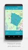
Creating and editing routes and markers
With MAPinr - KML/KMZ/OFFLINE, you'll have the freedom to customize every aspect of your experience. You can create markers to highlight key locations, plan detailed routes, and edit your maps as needed. In addition, the interface is intuitive enough to allow for quick adjustments on the fly, ensuring that you're always prepared for any changes you need to make to your plans. This feature is especially useful for professionals in fields such as surveying, field research, or specialized tourism.
Advanced geospatial data management
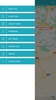
This app not only makes it easy to view maps, but it also allows you to manage multiple KML and KMZ files simultaneously. You'll have the option to combine data from different sources, import or export files to share with your team, and even overlay layers of information for a more comprehensive perspective. This flexibility makes this app a valuable tool for geospatial analysts, engineers, and urban or rural explorers.
Requirements (Latest version)
- Android 6.0 or higher required
Comments
Old map no